Our Atlassian EEA team, develops various specific extensions for Atlassian products that bring new functionality to these systems and thus extend their use. It often happens that customers cannot find the application they need on the market, so they can contact us to make the tailor-made solution.
One of these JIRA applications is Geodata, which allows to add a GPS position to Jira’s tasks. You can display these tasks on a map, filter them, and then fully utilize Jira’s functionality to solve such tasks.
Examples of geodata usage in Jira
Bratislava New Town – Participatory Budget:
The Participatory Budget Office registers, handles suggestions from citizens in Jira and publishes oficial statements. With the help of Geodata it clearly displays selected information on suggestions viewable on map on its Citizens Portal. Selected data can be published as Opendata datasets through the REST interface with GeoJSON and it is possible to display the data on maps in other systems. In addition, the solution is used to visualize pavement repair and displaying of completed and planned projects in the city
A company from the industrial sector
- Map of customer’s installed measuring and fire extinguishing equipment
Further use is for customer’s service and business team. Client can display a list of installed devices at his customers. It uses map visualization to manage onsite service interventions, so they optimize the work path using the map.
Geodata functionality
We customized the functionality for 2 categories of customers:
- Users who do not have a Jira account, such as Citizens, use JIRA task functionality (by Webcollector, email or JIRA Service Desk). The inputs can be viewed on map, either directly in JIRA or through integration into other portals such as Liferay. They can vote through our Voting application for specific suggestions, or comment on suggestions through Disquss integration.
- Those who have Jira account and adequate permissions for example managers, service team, or employees of Self-Governing Region can use Geodata full functionality:
-
- input suggestions directly over the map (point, polygon)
- edit the address directly on the map
- Transform address to exact location (GPS)
- link directly to the cadastral map with the respective ground plot under which the given address belongs http://mapka.gku.sk/mapovyportal/
- specific processes to address suggestions etc.
- ability to view tasks on map, filter them, process by jira processes, assign them, etc., There are also automatic task filters based on the current map section
- can edit task datasets with addresses, define their filtering options etc.
- Publish Opendata datasets through the REST interface
- Use custom tile server or Openstreetmap
- planning a trip through Google map route
- dashboard gadget
Service desk funkcionality:
-
- Entering an address via the SD portal and then transforming the entered address into GeoJson
- Assigning tasks to responsible persons based on the Geographical location of the address of the assigned task, or the address of the Requester
How to create a geo task
In addition to the standard text address input (via webcollector, Jira servicedesk, where the address is entered and then automatically transformed to GeoJSON that is visualized on the map), we can create tasks directly on the map where the location is selected – point or whole area, issue type and then, after saving, the next step opens the screen to enter additional task data, which is the standard JIRA functionality.
Placing a point on a map. – Selecting the project and the issue type, then after data is saved, additional information about the task can be entered. Example area – the selected area of Kuchajda, the first point will be saved as the task address, which can be then used for fultext search (Tomášikova, Bratislava)
Working with the map
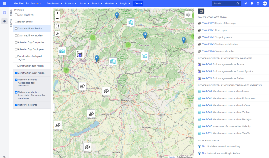
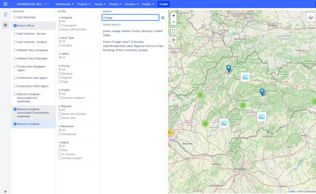
The tasks on the map can be filtered through defined datasets, that contain attributes for further filtering. A standard task list with JQL search is also available.
The map zoom also filters tasks in th task list, with additional JQL filter possibility.
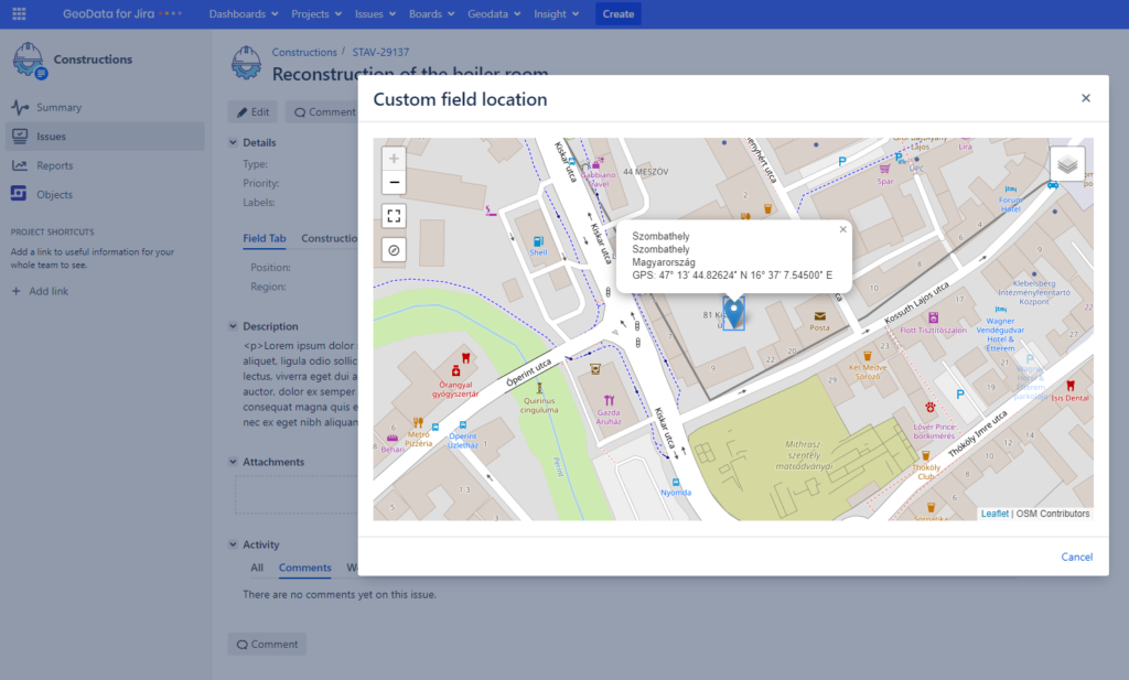
When you click on the marker, you will see a preview that contains the task data. From the preview you can browse to the task detail or change the task location.
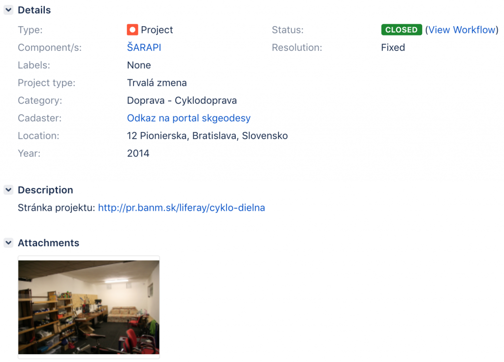
The task details show the address of the given location, you can fulltext search the address, or you have a direct link on the cadastral map where you can find information about the plot.
Geodata configuration
- Definition of custm dataset
-
- Specifies which data to publish in the dataset (task attributes, attachments, custom fields)
- Define filters on maps for specific datasets – possibility to select on which attributes the tasks will be filtered on the map
- Define the columns in the filter on the map
- Setting the default dataset
- Basic map centering and zoom map settings
- Tile server – default Openstreetmap, the possibility to enter your own Tile server
- Marker color definition on the map
- Allow displaying links to google maps
- Displaying of Geo menu in JIRA
- Enabling additional types of objects: Polyline, Polygon, Rectangle
You can find more information in our Administrator’s Guide documentation.
Try our application on our demo server.
https://geodata.eea.sk
Username: demo-user
Password: demo-user
If you are interested in Geodata application and have an idea how to use it in your company, do not hasitate to contact us.
Andrej Ďumbala
Atlassian consultant