Application

GeoData for Jira

Manage Jira issues and Insight objects on the map with GPS position.  Take advantage of the optimization of service or business activities in a given location.

APPLICATION DESCRIPTION

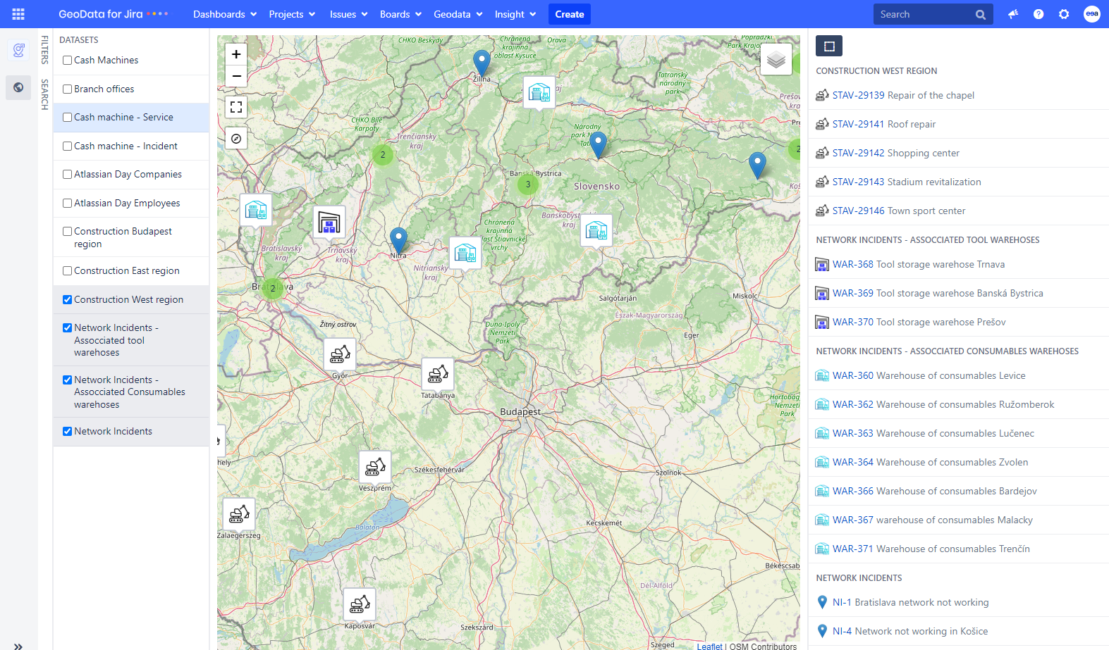
GeoData for Jira is a powerful tool that allows you to manage Jira issues and Insight objects on a map with GPS positions. When you see your data on the map, you can gain a clearer understanding of everything. With an immediate overview of which areas are the busiest, it becomes easier to plan trips for employees and make strategic decisions that are much more effective.

Furthermore, you can find geographical connections between various problems and tasks, which can lead to better solutions. Through data visualization, valuable resources and time can also be saved within the company.


Geodata for Jira blog – Maximizing Jira Efficiency: Location Mapping for Task and Assets

Geodata for Jira blog – Make your work easier by visualizing data thanks to the Geodata for Jira application

Geodata for Jira blog – A different view of data. Customer experience with Geodata for Jira
ADVANTAGES

Precision

Visualize Jira issues and objects on a map with precise GPS location

Efficiency

Excellent possibilities for process automation based on location

Connectivity

Link various external services such as Google Maps and the ability to route them

Collaboration

Share location-based information with team members.

PREVIEW

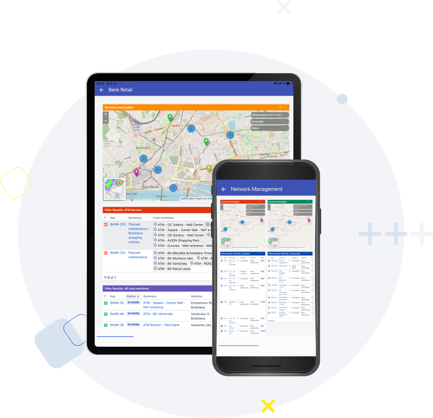
Discover GeoData for Jira: Seamlessly add, visualize, and filter location data for enhanced issue management.

  • Add, find, and edit GPS positions in Jira issues.
  • Display locations on maps.
  • Group objects based on common attributes and refine displayed locations using filters.

Extended description of functions:

  • Add Locations: Easily track critical business locations and associate addresses with your issues. Multiple locations can be added to a single issue.
  • Find Locations: Use the map view or search functionality to locate addresses. Pinpoint a specific location or choose the closest matching address.
  • Edit Locations: Modify addresses for relocated offices or update meeting locations. Customize display names for descriptive labeling.
  • Display Locations on Maps: View all pinned locations on the issue detail screen. Utilize the map board to visualize locations from all Jira issues.
  • Datasets: Group objects with common attributes, such as issue types or Insight objects. Specify which issues or objects are included in a dataset.
  • Filters: Refine displayed locations based on selected criteria.
KEY FEATURES

GeoData for Jira provides the following key features:

Visualize Jira issues and Insight objects on a map
Manage data by adding GPS coordinates to Jira issues and Insight objects
Share location-based information with team members to improve collaboration and decision-making
Optimize service or business activities in a given location
Planning the most efficient journey for your employees
Route planning on your mobile
THEY SAID ABOUT US

After trying different systems, excel spreadsheets, we finally settled on Jira by Atlassian and GeoData for Jira for construction data management. What you get out of your geodata depends entirely on your pursued goals and creativity.

K. Senderáková
Project Manager

We specialise in fire protection and use GeoData to visualise the locations of fire extinguishers across the country. The application allows us to plan routine maintenance or technician calls for equipment in need of repair more efficiently.

Fire Protection System Supplier

The ability to map data and analyze it geographically is a great asset.

Project Manager
THE APP IS ALSO USED BY:
FREQUENTLY ASKED QUESTIONS

GeoData is priced per user, starting at $1 per user. The more users you have, the cheaper the price per user is. Pricing also differs depending on your hosting options. If you want to know more about our pricing, visit the Atlassian Marketplace.

Get a 30-day free trial of GeoData’s full functionality by installing this Jira plugin from the Atlassian Marketplace. Once your admin has installed GeoData, all users can enjoy a free trial for 30 days, after which a fee is required to continue using the app.

Yes we do! We can show you a demo on a video call. We will also assist your admin during the configuration. And if you bump into any issues, you can submit your ticket through our service desk.

Your Jira issues will be enriched with amazing functionality by adding the location (address) and presenting the issues on the map.

  • You can solve a lot of your daily tasks with core Jira functionalities such as different issue types or workflows.
  • The GeoData application brings you several features that may help you do more.
  • You can visualize your tickets on a map and see your data from a new perspective.
  • You can easily view issues that are close to each other, find hot-spots from a heatmap view and much more.
  • Jira Service Desk customers can add information about the location directly into their requests, and it helps you handle them effectively.

You can find out more in the documentation.

There are many cases where GeoData for Jira can be used. To give you two examples:

  • A local government office registers and resolves suggestions from citizens in Jira and publishes opinions on them, using Geodata to clearly display selected data about the suggestions on a map on its portal for citizens.
  • construction company uses our app to maintain a map of installed metering and fire extinguishing equipment at a customer’s site. It uses visualization on the map to manage onsite service interventions, i.e., they optimize their workflow using the map.

Yes it does! GeoData for Jira provides external linking to web services like Google Maps. You can plan a trip using Google Maps routes from Jira issues and also handle GeoData Insight object custom fields for Google routes.

You can connect GeoData with OpenStreeMap. Furthermore, our product roadmap covers integration with ESRI. You can also connect GeoData with weather services.
OTHER APPS YOU MIGHT BE INTERESTED IN

GeoData for Jira

Manage Jira issues and Insight objects on the map with GPS position. Take advantage of the optimization of service or business activities in a given location.

Jira Cloud, Jira Server, Jira Data Center, Jira Service Management  

Page Tree Visualization

Easily visualize your Confluence page tree as diagram. Simplify the navigation of your Confluence knowledge base.

Jira Server, Jira Data Center, Jira Cloud